
Hoteles en Alton, UT desde $1,048 MXN
 Anticípate a los cambios de planesReserva hoteles con cancelación gratis.
 Elige tu opción idealBusca entre casi un millón de propiedades en el mundo.
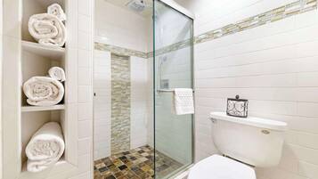
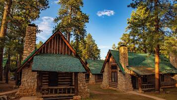
Encuentra un hospedaje especial en Alton
Cabañas
Departamentos
Consulta precios para estas fechas
Mañana
Este fin de semana
Próximo fin de semana
Nuestra selección de hoteles en Alton


Bryce Canyon Pines
Bryce Canyon PinesBryce Canyon
8.0 de 10, Muy bueno, (1,008 opiniones)
“Habitación amplia buena calefacción buena ubicación cerca del parque.
Hay parqueadero y ambiente tranquilo. ”

CESAR
El precio actual es de $1,233 MXN
$1,393 MXN en total
impuestos y cargos incluidos
24 jun. - 25 jun.


Rodeway Inn Bryce Canyon
Rodeway Inn Bryce CanyonPanguitch
8.0 de 10, Muy bueno, (1,003 opiniones)
“Para el precio es una excelente opción ”
Carlos Mario
El precio actual es de $937 MXN
$1,058 MXN en total
impuestos y cargos incluidos
5 jul. - 6 jul.


Historic Smith Hotel B&B
Historic Smith Hotel B&BGlendale
9.2 de 10, Magnífico, (526 opiniones)
“Este alojamiento se encuentra en un pueblecito que no tiene nada mas. La habitación es pequeña, y al menos a nosotros no nos la hicieron el segundo dia. La habitación esta limpia, aunque no asi la terraza compartida a la que se podía acceder desde la habitación. Dispone de un frigorifico y microondas compartido en una habitación que usan como cocina. El desayuno era lo que te traia la mujer, sin mas opción.”

Paco
El precio actual es de $1,735 MXN
$1,976 MXN en total
impuestos y cargos incluidos
26 jun. - 27 jun.


89 & Nine Motel
89 & Nine MotelOrderville
8.6 de 10, Excelente, (202 opiniones)
“Gran lugar para dormir y disfrutar Mt Carmel
”
Ariana Guillermina
El precio actual es de $1,540 MXN
$1,770 MXN en total
impuestos y cargos incluidos
25 jun. - 26 jun.


Bryce GatewayInn Cabins
Bryce GatewayInn CabinsPanguitch
7.8 de 10, Bueno, (869 opiniones)
El precio actual es de $1,137 MXN
$1,284 MXN en total
impuestos y cargos incluidos
24 jun. - 25 jun.


Best Western East Zion Thunderbird Lodge
Best Western East Zion Thunderbird LodgeOrderville
9.2 de 10, Magnífico, (1,003 opiniones)
“Habitacion cómoda y limpia. ”
Carlos M
El precio actual es de $1,929 MXN
$2,217 MXN en total
impuestos y cargos incluidos
5 jul. - 6 jul.


The Lodge at Bryce Canyon
The Lodge at Bryce CanyonBryce Canyon
8.8 de 10, Excelente, (98 opiniones)
“- very nice stay
- unique location within the Bryce Canyon NP
- lovely staff at the front desk - always helpful and with a smile ”

Nikolaj
El precio actual es de $3,170 MXN
$3,580 MXN en total
impuestos y cargos incluidos
6 jul. - 7 jul.


The Riverside Ranch RV Park, Motel & Campground
The Riverside Ranch RV Park, Motel & CampgroundHatch
9.2 de 10, Magnífico, (591 opiniones)
“Molt bona gent. Molt amables i calidesa en el tracte.
Sens dubte, hi tornaria i segur que hi estaria mes nits.
Muy buena gente. Muy amables i trato cálido.
Sin duda, volveria y estaria más noches.
Very nice people. Very kindly and warm relationship.
I will no dubt to come again and spend more nights.”
Viajero anónimo
El precio actual es de $1,670 MXN
$1,886 MXN en total
impuestos y cargos incluidos
30 jun. - 1 jul.

Bryce Zion Inn
Bryce Zion InnHatch
7.8 de 10, Bueno, (553 opiniones)
El precio actual es de $919 MXN
$1,048 MXN en total
impuestos y cargos incluidos
24 jun. - 25 jun.


Mountain Ridge Cabins and Lodging
Mountain Ridge Cabins and LodgingHatch
9.2 de 10, Magnífico, (1,004 opiniones)
“Mejor imposible. Absolutamente recomendable”
MARIA T
El precio actual es de $1,481 MXN
$1,703 MXN en total
impuestos y cargos incluidos
25 jun. - 26 jun.

Hatch Station Motel and Restaurant
Hatch Station Motel and RestaurantHatch
8.4 de 10, Muy bueno, (437 opiniones)
“De acuerdo a mi reserva el precio ya incluía taxes, Sin embargo no aceptaron esto y me volvieron a cobrar lo taxes. Hay mejores opciones mas cerca a Bryce canyon y mas económicas”

Rodolfo
El precio actual es de $1,197 MXN
$1,377 MXN en total
impuestos y cargos incluidos
23 jun. - 24 jun.


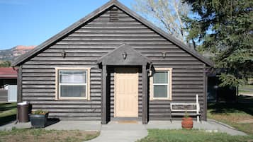
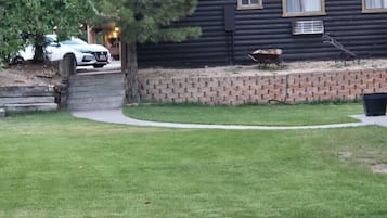
Arrowhead Country Cabins
Arrowhead Country CabinsMount Carmel
9.6 de 10, Excepcional, (86 opiniones)
“We spent two nights in this cabin. The location was great for us visiting Zion and Bryce Canyon National Parks. Only issue with the cabin was, the AC didn’t cool as good as I wanted and the vent wouldn’t stay set in place. The breakfast was good but doesn’t compare to the one at the name brand hotels and the cost was a lot more than the hotels. We had a good experience but, next time I would choose the hotel.”

James
El precio actual es de $2,613 MXN
$3,697 MXN en total
impuestos y cargos incluidos
4 jul. - 5 jul.


Duck Creek Village Inn
Duck Creek Village InnDuck Creek Village
9.4 de 10, Excepcional, (175 opiniones)
El precio actual es de $3,008 MXN
$3,532 MXN en total
impuestos y cargos incluidos
6 jul. - 7 jul.


Aspen Cove resort
Aspen Cove resortPanguitch
7.0 de 10, Bueno, (66 opiniones)
“I only stayed one night. Found bed bugs. Couldn’t get a hold of anyone. ”
Frankie
El precio actual es de $1,891 MXN
$2,135 MXN en total
impuestos y cargos incluidos
5 jul. - 6 jul.

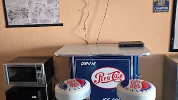


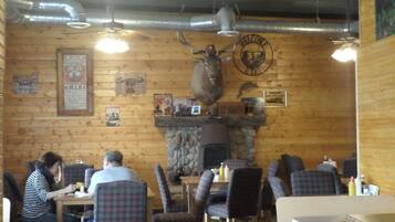
Galaxy of Hatch between Bryce and Zion
Galaxy of Hatch between Bryce and ZionHatch
8.4 de 10, Muy bueno, (31 opiniones)
“The decor was unique, with a motorcycle theme. The room was not fancy but clean, cleverly appointed and surprisingly quiet. It offers reasonable prices, and is an easy drive to Bryce Canyon.”
Ed
El precio actual es de $1,233 MXN
$1,406 MXN en total
impuestos y cargos incluidos
23 jun. - 24 jun.


Red Canyon Village
Red Canyon VillagePanguitch
6.0 de 10, (2 opiniones)
“We canceled .
It was a terrible location right on a busy hwy and RVs all over totally misrepresented on the web site
The manager said he canceled it on your end and I spoke with you virtual assistant who told me that the charges would be removed
Please expedite this matter
Thank you”
Peggy
El precio actual es de $2,585 MXN
$2,918 MXN en total
impuestos y cargos incluidos
23 jun. - 24 jun.


Between Bryce Canyon & Zion: Hiker's Paradise!
Between Bryce Canyon & Zion: Hiker's Paradise!Hatch
El precio actual es de $2,463 MXN
$5,579 MXN en total
impuestos y cargos incluidos
24 jun. - 25 jun.


The Lodge at Duck Creek
The Lodge at Duck CreekMeadow View Heights
9.4 de 10, Excepcional, (96 opiniones)
“Clean, quiet area, comfortable and cozy ”
Andrea
El precio actual es de $3,074 MXN
$6,115 MXN en total
impuestos y cargos incluidos
6 jul. - 7 jul.


Duck Creek Village Cabin Near National Forest!
Duck Creek Village Cabin Near National Forest!Meadow View Heights
El precio actual es de $2,550 MXN
$7,611 MXN en total
impuestos y cargos incluidos
6 jul. - 7 jul.
Precio más bajo por noche encontrado en las últimas 24 horas, con base en una estancia de 1 noche para 2 adultos. Los precios y la disponibilidad están sujetos a cambios. Aplican términos adicionales.

Inicia sesión y ahorra en promedio 15% en miles de hoteles
Hospédate cerca de algunas de las atracciones destacadas de Alton
Más información sobre Alton
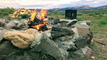
Las áreas de senderismo, la vida silvestre y las actividades de aventura te esperan en Alton.

Foto por Eric & Kristy's Adventures
Foto de uso libre por Eric & Kristy's Adventures


Hospedaje barato en Alton

Rodeway Inn Bryce Canyon
3090 UT 12 Panguitch UT
El precio es de $937 MXN por noche del 5 jul al 6 jul
$937 MXN
$1,058 MXN en total
5 jul. - 6 jul.
impuestos y cargos incluidos
8/10 Very Good! (1,003 opiniones)


Preguntas frecuentes
Explora el mundo con Expedia
- Hoteles cerca de Bryce Canyon
- Hoteles cerca de Bosque nacional Dixie
- Hoteles cerca de Brian Head
- Hoteles en Brian Head
- Hoteles en Bryce Canyon
- Hoteles cerca de Bryce Canyon National Park Visitor Center
- Hoteles en Cannonville
- Hoteles cerca de Centro comercial Old Bryce Town
- Hoteles cerca de Cueva Mammoth Cave
- Hoteles cerca de Cueva Moqui
- Hoteles en Condado de Kane
- Apart-Hoteles en Duck Creek Village
- Casas de ciudad en Duck Creek Village
- Chalets en Duck Creek Village
- Hoteles de ski en Duck Creek Village
- Hoteles de lujo en Duck Creek Village
- Hoteles en la playa en Duck Creek Village
- Hoteles familiares en Duck Creek Village
- Hoteles románticos en Duck Creek Village
- Hoteles baratos en Duck Creek Village
- Hoteles en Duck Creek Village
- Lodges en Duck Creek Village
- Hoteles cerca de Entrada este del Parque Nacional Zion
- Cabañas en Glendale
- Campings en Glendale
- Casas de huéspedes en Glendale
- Hoteles en Glendale
- Resorts en Hatch
- Hoteles para ir de compras en Hatch
- Hoteles románticos en Hatch
- Hoteles en Hatch
- Hoteles en Kanab
- Hoteles en Long Valley Junction
- Hoteles cerca de Martillo de Thor
- Hoteles cerca de Mirador Bryce Point
- Hoteles en Mount Carmel
- Hoteles cerca de Navajo Trail
- Hoteles en Orderville
- Hoteles en Panguitch
- Hoteles cerca de Parque Nacional del Cañón Bryce
- Hoteles cerca de Red Canyon
- Hoteles cerca de Red Canyon Visitor Center
- Hoteles cerca de Sunrise Point
- Hoteles en Tropic
- Apart-Hoteles en Utah - Cañón de Bryce
- Cabañas en Utah - Cañón de Bryce
- Campings en Utah - Cañón de Bryce
- Centros vacacionales en Utah - Cañón de Bryce
- Resorts en Utah - Cañón de Bryce
- Hoteles de golf en Utah - Cañón de Bryce
- Hoteles de ski en Utah - Cañón de Bryce
- Hoteles de lujo en Utah - Cañón de Bryce
- Hoteles boutique en Utah - Cañón de Bryce
- Hoteles cerca del bosque en Utah - Cañón de Bryce
- Hoteles cerca del lago en Utah - Cañón de Bryce
- Hoteles con alberca en Utah - Cañón de Bryce
- Hoteles con restaurante en Utah - Cañón de Bryce
- Hoteles en la naturaleza en Utah - Cañón de Bryce
- Hoteles de La Quinta Inn & Suites en Utah - Cañón de Bryce
- Lodges en Utah - Cañón de Bryce
- Moteles en Utah - Cañón de Bryce
- Visita Alton
- Cueva Mammoth Cave
- Visita Duck Creek Village
- Vacaciones en Glendale
- Paquetes de vacaciones Luna de Miel cerca de Utah - Cañón de Bryce
- Paquetes de vacaciones Vacaciones de aventura cerca de Utah - Cañón de Bryce
- Paquetes de vacaciones Vacaciones de golf cerca de Utah - Cañón de Bryce
- Paquetes de vacaciones Vacaciones todo incluido cerca de Utah - Cañón de Bryce
- Mirador Piracy Point
- Mirador Rainbow Point
- Visita Orderville
- Visita Utah - Cañón de Bryce
- Valle Agua Canyon
- Autos de renta de Dirent en Utah - Cañón de Bryce
- Autos de renta de Dollar en Utah - Cañón de Bryce
- Autos de renta de Firefly en Utah - Cañón de Bryce
- Autos de renta de Hertz en Utah - Cañón de Bryce
- Autos de renta de Locauto en Utah - Cañón de Bryce
- Autos de renta de OK Mobility en Utah - Cañón de Bryce
- Renta de autos en Alton
- Autos de renta de Sixt en Utah - Cañón de Bryce

